- Benefits
Pedagogy and Assessment
- Creating
the Mobile Experience
and why the GPS didn't work in this phase
Creating
and Analyzing
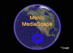
Menlo
MediaScape: Phase 1
images
courtesy of Google Earth |
![]()
Goals and Theoretical Framework
This project shares goals with digital storytelling and community-based media scaping:
- Use media technologies
as tools for
- community building
- develop a community’s stories – and history
- link a community back to its stories
- creating stories from the grassroots that matter
- transcendence, transformation, resistance
- personal change / societal change
- people telling their stories
- people hearing the stories
- community building
A larger theoretical and practical framework can be found in the study of alternative, grassroots, community-based media:
- Using media
to facilitate communication and understanding between and among
people
- usually non-commercial / non-corporate
- often produced by non-professionals
- examples:
- “underground” newspapers
- public access cable tv
- “Link” (Direct TV) and “Free Speech TV” (Dish)
- community-based radio
- web-based citizen journalism
- community technology movement
- Additional
information
- "The
Praxis of Access: Access and Global Activism"
by John W. Higgins, Community Media Review,
Summer 2004
- "The
Praxis of Access: Access and Global Activism"
![]()
Project Stages
The stages involved thus far in the project:
- Research
- Menlo College History
- select stories
- Production
- write the script
- produce media stories from script
- Post Production
- change the media stories into format used for hand-held and the web
- re-edit media stories
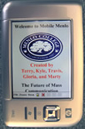
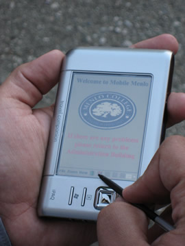
- Programming: Mobile Menlo
- Learn the GPS-based software to create Mobile Menlo
- Program the hand-held device
- Sync the GPS coordinates of Menlo College with the GPS
hand-held device - Programming: Menlo MediaScape
- Adapt media stories to web-based map
- Testing
- adapting media / programming
- re-testing
![]()
The Future
Upcoming phases in the project:
- Additional research
- collect oral histories
- Add layers of stories, sounds, visuals
- Technical
- refine media stories
- refine web site
- refine the hand-held issues
- GPS coordinates
- integrate software with GPS hand-held
- software update: May 2007
- will work
on all “smart
phones”
- based on Windows Mobile OS
- will work
on all “smart
phones”
![]()
Benefits: Pedagogy and Assessment
Some of the benefits related to pedagogy and assessment provided by the project::
- Experiential learning
- pedagogy: practice before theory
- fun!
- Service learning
- pedagogy: service to the community
- fun!
- Assessment -- portfolio
- Evidence of student learning
- together with
Menlo College
student projects: digital storytelling and other projects
![]()
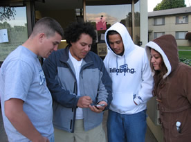
Creating the Mobile Experience
A few of the steps involved in the technical creation of the mobile portion of the project:
- Locate an appropriate
GPS-based map that utilizes UTM coordinates
- UTM = Universal Transverse Mercator
- different system than latitude / longitude
- Crop map to fit active geographical area
- Apply GPS coordinates of the Menlo campus to the map
- Set up hot-spots at specific coordinates on the map
- when walk into hot-spot, media event is triggered on the hand-held
Well, that's the theory anyway -- getting all this to happen is quite laborious, with repeated testing, analysis, troubleshooting, re-testing. As it turned on in Spring 2007, the coordinates were off -- so the GPS portion did not work on the Menlo campus. But, analysis concluded that someone about a mile away with the right equipment might be picking up the Menlo MediaScape signal and stories.
In the meantime, the M-Scape software update of May 2007 has greatly simplified the programming and compilation process -- so check back in late Fall 2007 for updates to Menlo MediaScape!
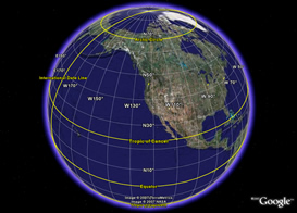
Earth -- latitude and longitude
(from Google Earth)
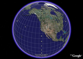
Earth -- Universal Transverse Mercator
(from Google Earth)
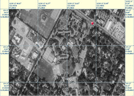
UTM grid of Menlo College campus
(from TerraServer)
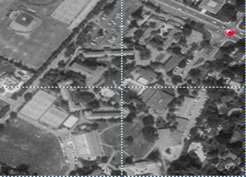
Cropped UTM grid of Menlo campus
(from TerraServer)
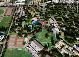
Aerial view of Menlo campus
(from Google Earth)
Campus map with defined "hotspots"
linked to GPS coordinates
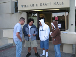
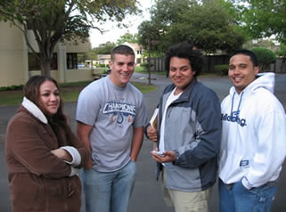
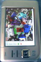
Testing:
Looking for a satellite signal
(Flash video)
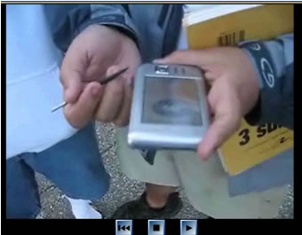
Testing:
Looking for an active GPS hotspot
(Flash video)
 Get
the free
Get
the free